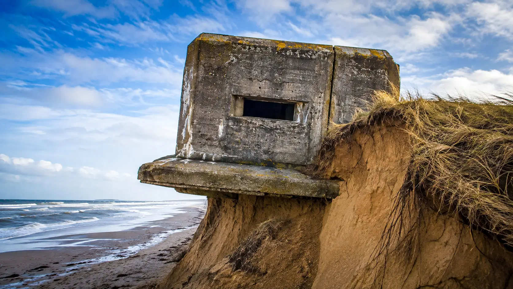
The remnants of concrete bunkers from 1944 are currently tumbling into the Atlantic Ocean. These structures, far from being mere military ruins, are providing unprecedented insights into coastal erosion while also posing significant financial challenges for coastal municipalities.
Concrete giants built with shallow foundations resting on sandy soil
From March 1942 to 1944, the German military constructed 15,000 fortified structures along the coast from Norway to Spain. This monumental effort utilized around 290,000 workers and consumed 13 million cubic meters of concrete. However, these massive structures were inherently flawed from the outset, lacking deep foundation anchoring.
A typical Class B bunker required 775 cubic meters of concrete and 35 tons of steel. Once completed, each fortress weighed nearly 1,900 tons. Even the smaller gun emplacements weighed several hundred tons, positioning them precariously on sandy ground.
Each bunker rested solely on a foundation slab that was 80 centimeters thick, placed directly on compacted sand. The engineers did not incorporate any deep anchoring piles, meaning that the structural stability of these edifices relied entirely on the integrity of the dune beneath them.
Coastal erosion undermines the ground beneath these structures, causing them to slide into the sea
Geographer Marc Robin notes that these massive structures do not move on their own. Instead, the continuous battering from waves erodes the sand supporting their bases. For instance, at Pen Bron, the dune has retreated 25 meters, leading to the collapse of a bunker in May 2026.
Other coastal areas are experiencing similar phenomena. In Wissant, the coastline has receded by over 20 meters in just six years. Additionally, on the Île de Ré, four bunkers have slipped as a result of a 50-meter dune retreat, while structures at Pilat are now situated 100 meters lower.
Fixed geographical position makes these remnants accurate geological markers
Ironically, the German military has left behind a valuable tool for scientists. Built at known locations in 1944, these monoliths now serve as reliable geological markers. They facilitate the assessment of coastal erosion rates without relying on sometimes inaccurate historical maps.
Advanced LiDAR surveys and ground measurements affirm the importance of these historical witnesses. Researchers can easily compare their original locations with their current positions. Therefore, these enduring blocks vividly illustrate the relentless advance of the ocean over sand dunes.
Furthermore, some structures have completely submerged under the water. In Gironde, divers now explore these sunken fortresses at depths of twenty meters. Transformed into artificial marine habitats, these remnants of war now support a diverse array of marine life, far removed from their original military purpose.
Legal vacuum forces municipalities to bear the cost of securing these ruins
The collapse of these structures raises a complex legal issue. Initially located on private or municipal property, they fall into the public maritime domain as the tide encroaches. The state theoretically becomes responsible for managing these now hazardous ruins.
However, local governments are not always willing or able to assume this burden. For example, local officials on the Île de Ré spent 275,000 euros to dismantle four threatening bunkers. This financially unjust situation significantly strains the budgets of small coastal municipalities left to manage these challenges alone.