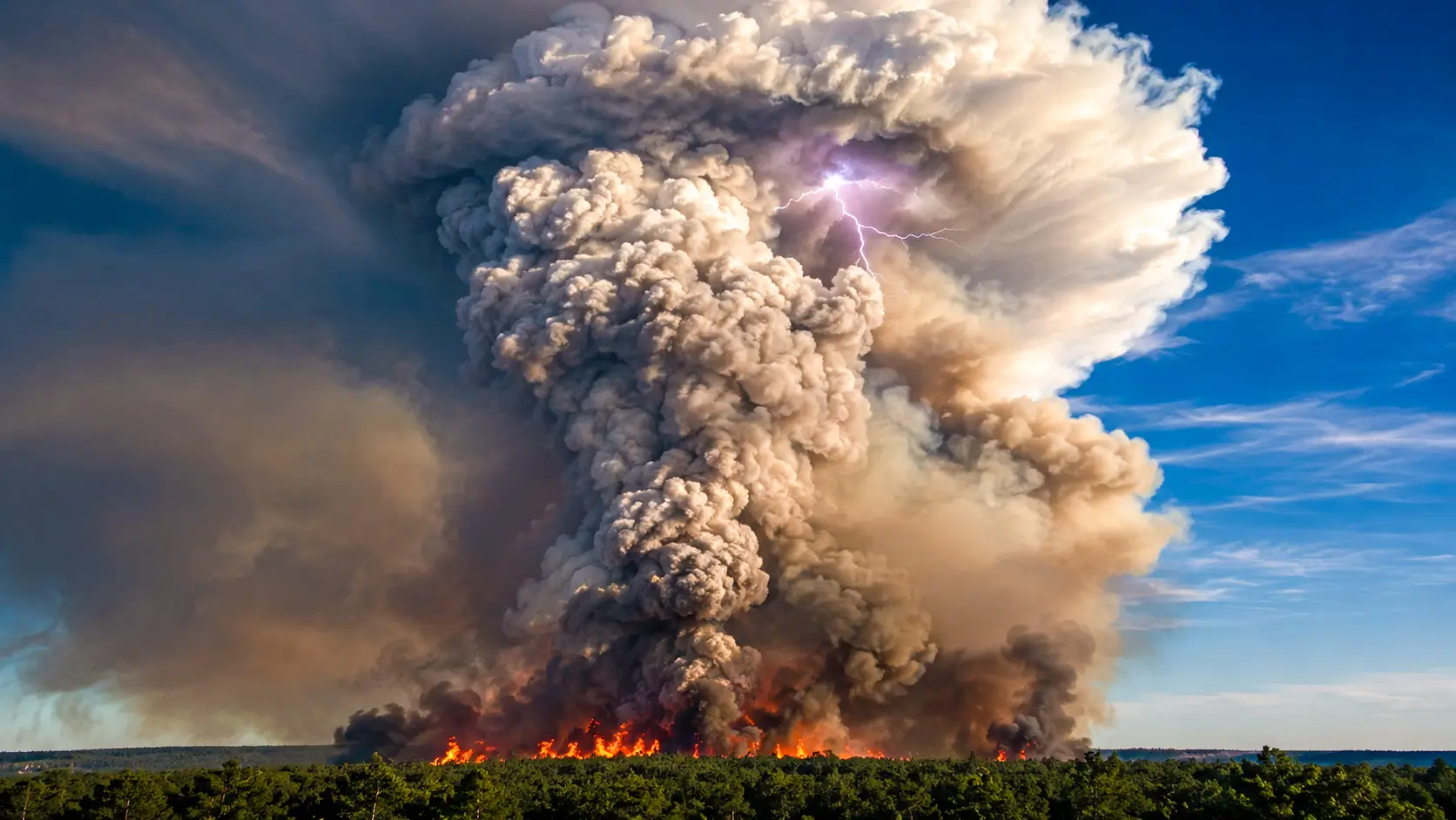
An extraordinary cloud capable of generating its own lightning formed over Gironde on July 24, 2026. This phenomenon, unprecedented in France, is prompting researchers to develop algorithms that can detect such occurrences up to 24 hours before they happen.
In Gironde, a fire created its own self-sustaining storm
Originating from Saumos in the Médoc on July 22, 2026, a fire raging across the Arcachon Basin has reached a rare threshold: it now generates its own conditions for spreading. “This is a phenomenon never before observed in France,” summarized Marc Vermeulen, director of the départemental fire and rescue service in Gironde.
Specifically, the heat produced by the flames creates a powerful convective column that draws in cooler air, feeding the fire like a giant self-sustaining chimney. As a result, the fire moves beyond the influence of external winds.
Why simulation software fails to predict this type of combustion
Convective fires have a unique characteristic: they generate their own weather, including their own winds. Their paths become erratic, no longer following the dominant flow predicted by Météo-France, complicating the efforts of ground teams.
Once a certain altitude is surpassed, the water vapor in the plume condenses into a storm cloud. This cloud produces its own lightning and initiates embers that can ignite new, unpredictable hotspots far ahead of the flames.
Simulation software typically used by rescue teams is based on a simple assumption: a fire driven by external wind and terrain. This self-feedback mechanism of the fire is almost entirely overlooked, remaining invisible when only synoptic wind maps are considered.
Pyrocast, the program that detects warning signs of a fire storm
The Pyrocast pipeline, developed in part by researchers from the University of Cambridge, relies on a database compiling satellite imagery and environmental data for over 148 pyroCb events in North America, Australia, and Russia between 2018 and 2022.
Random forests, convolutional neural networks, and auto-encoder pre-trained models were analyzed to predict the formation of a pyroCb up to six hours in advance. The most effective model achieved a ROC curve area of 0.90, indicating a highly reliable form of discrimination.
A 2026 version expands the inventory to 214 events in the United States and Canada from 2013 to 2020, tested on 91 cases from 2021, with a targeted anticipation window of up to 24 hours. In the US, NOAA forecasts smoke within a similar timeframe, and an Indian team has adapted Pyrocast for the Meteosat satellite.
A useful alert, but far from a crystal ball for firefighters
A score of 0.90 does not transform an algorithm into a crystal ball. These models have been trained on only a few hundred global events, a minuscule sample compared to the diversity of terrains and vegetation. A fire in a pine forest differs significantly in thermal signature from an Australian or Canadian boreal fire.
Alerts issued 12 to 24 hours in advance could reposition aerial resources before a shift occurs, prepare for preventive evacuations, and inform air traffic. It remains to be seen if French rescue services, still not well-equipped to integrate these models, will be able to translate this statistical advantage into effective operational decisions.